The Arctic polar cap has been melting at an astonishing rate over the past 20 or so years. In addition to causing higher sea levels and other environmental impacts, the decreasing surface is opening up new resources and allowing for new transportation and shipping opportunities.
As interest in the region grows among industries and nations, there’s a pressing need for greater knowledge about what’s happening in the Arctic Ocean. UConn’s UnderWater Sensor Network (UWSN) Lab is developing a wireless system to collect data in the ice-covered region, with funding from the National Science Foundation.
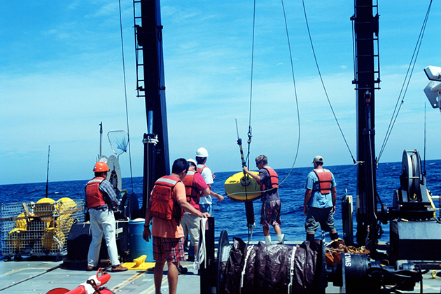
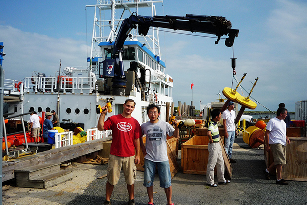
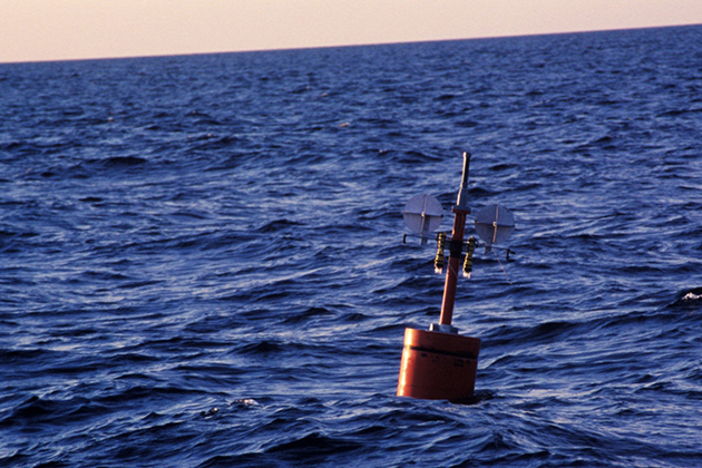
The team at UConn will be working with researchers at University of Delaware, who are interested in sea ice changes and ocean acoustics. The UWSN Lab will design and deploy the underwater communication network, which will wirelessly stream data – including sea temperature, acoustics, and current velocity – from the bottom of the sea through acoustic waves from sub-surface ocean sensors to a control center.
The UConn team working on the three-year, $800,000 project is led by Zheng Peng, assistant research professor in the Department of Computer Science and Engineering. Together with Jun-Hong Cui, professor of computer science and engineering, and Shengli Zhou, professor of electrical and computer engineering, the researchers will speed up the flow of information for Arctic oceanographers, acoustic communication scientists, and computer network engineers by providing data in real time from beneath the surface of the Arctic.
Specifically, they will collect information on how acoustic waves form and move in this complex and dynamic region. The goal is to expand the capabilities of underwater communication networks in the area where the sea ice changes from stationary ice to mobile ice formations and then to open water. Receiving data from the sensors in real time, Peng says, is especially critical at times when corrective actions need to be taken quickly.

He expects that researchers will deploy the sensors off the coast of Thule, Greenland in 2016. It won’t be an easy task. Even under more stable conditions, deploying and sustaining wireless sensors is tricky. Keeping them powered, for one thing, is a challenge. While sensors attached to surface buoys can rely on solar energy, devices that are stationed deeper in the ocean have to rely on batteries with limited capacity.
“So we have to design our systems to be very, very energy-efficient,” Peng says.
And a volatile, ice-covered region presents its own particular set of challenges.
“In the Arctic , there are more severe problems,” says Peng. Glaciers can wreak all sorts of havoc to the sensors’ signals. Sometimes they block the signal altogether, or boost it in unpredictable ways. That calls for developing resilient hardware for the sensors.
More than 70 percent of the planet is water, Peng notes, and with resources on land “kind of limited,” people will eventually be going underwater to make up for that loss.
“But if we want to explore the ocean,” he says, “we have to build the network.”
Why wireless? It’s resilient, Peng says, and a lot cheaper.
The cost of underwater cables ranges from tens of thousand dollars to $1 million per kilometer. Wireless systems currently cost a few thousand dollars per kilometer, but these are for prototype systems. Costs are expected to go down significantly in the near future.
Another advantage of wireless, according to Peng, is its flexibility. With no prior infrastructure needed, quick deployment is possible. That’s particularly convenient when researchers identify a new area of interest and want to monitor it for a limited amount of time. Also, it can reach locations where it’s difficult to deploy underwater cable. There’s also a greater return on investment, because the sensors are relatively easy to recover, making it more likely they’ll be used again for additional projects.