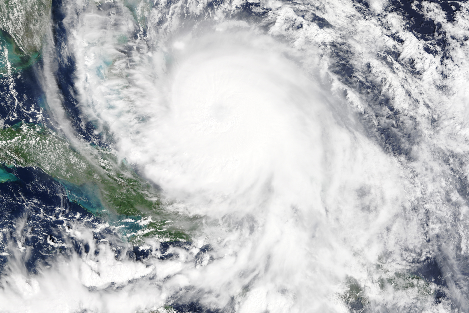
Recently, El Faro, a cargo ship heading to San Juan, Puerto Rico, foundered in the Atlantic Ocean off the Bahamas on October 5, 2015 due to Category 4 Hurricane Joaquin. Thirty-three crew members remain missing. The captain cut south of the storm, due to the rare occurrence of such storm systems traveling south, but ended up sailing straight into the high winds and seas in the area, a situation that had a high probability of happening given the forecast.
A tool for Navy ship route optimization, developed by doctoral candidate, David Sidoti of the Electrical and Computer Engineering Department studying under the advisement of Dr. Krishna R. Pattipati, was applicable to the problem so he ran it for this scenario. The algorithms he created were able to find safe routes for the ship that involved waiting at waypoints and varying the ship’s speed in order to avoid unsafe environmental conditions, while also reducing costs of the route.
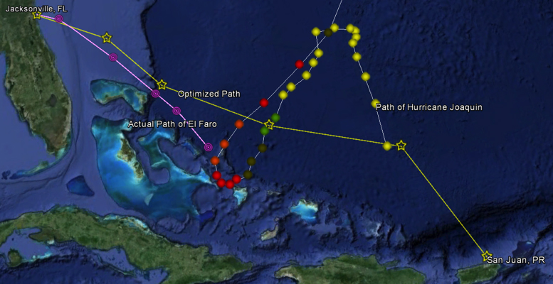
The developed tool (deemed TMPLAR, or Tool for Multi-objective Planning and Asset Routing) offers a key and vital innovation in the context of weather impacted ship routing: waiting locations in the sea to ensure ship’s safety and reduce costs. The embedded algorithms decide arrival and departure times at each waypoint. The tool was created in collaboration with Naval Research Laboratory – Monterey, enabling the algorithms to check bathymetry, and use accurate short and medium range weather predictions in conjunction with ship models (e.g., how a ship’s speed and power consumption may be impacted by the expected wind, wave, and current conditions). Commercial ship voyage planning modules are integrated with the tool to calculate the impacts of weather, ship’s hull form, cargo, and (power) plant characteristics on fuel costs.
Using the tool, up to eight possible safe routes were found, all of which required waiting at some point along the way to avoid the hazardous weather conditions induced by the hurricane. The “best” route possible is shown below (see picture), where “best” means minimized distance traveled, maximized fuel efficiency, and traveling only across safe seas – those locations on the ocean that do not exceed the ship’s physical limitations.
David’s work in dynamic resource management has resulted in numerous transitions to the real world, especially pertaining to counter-drug smuggling operations in collaboration with Naval Research Laboratory-Monterey and Joint Interagency Task Force-South. He has more than 30 research articles in peer-reviewed journals and international conference proceedings. He was recently an invited speaker at NATO’s Decision Support and Risk Assessment for Asset Planning 2015 Workshop. His current interests include multi-objective algorithms for dynamic scheduling and resource management in weather-impacted environments.