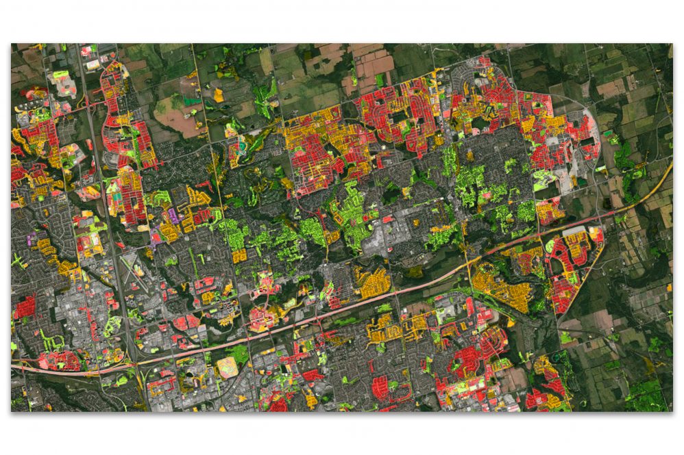
Mesmerizing photos of the Earth from space are now iconic images. Zooming in on satellite images and looking at features like fields, forests, or bodies of water can provide valuable insights into how things are changing on the ground.
The technology needed to use these images for scientific research are also getting a closer look from academics and industry alike.
The UConn Global Environmental Remote Sensing (GERS) Laboratory is partnering with CATALYST to develop technologies that have the potential to radically improve the ability to study changes to landscapes over time.
CATALYST is a PCI Geomatics brand that provides proven software and information solutions rooted in photogrammetry and remote sensing to geospatial professionals, and downstream users of geospatial information.
Zhe Zhu, director of GERS Laboratory and assistant professor in UConn’s Department of Natural Resources and the Environment, developed an algorithm for Continuous Change Detection and Classification (CCDC) of land cover that uses all available data from Landsat, a joint USGS-NASA effort that provides satellite images of Earth dating back to the 1970s.
Through this collaboration, Zhu will work with CATALYST to move from pixel-based to object-based algorithms.
When work is done at the pixel-level of an image, there is a lot of noise that can get in the way of researchers’ analysis. By looking at the object-level, scientists can analyze changes to a particular landscape or land feature over time with important detail.
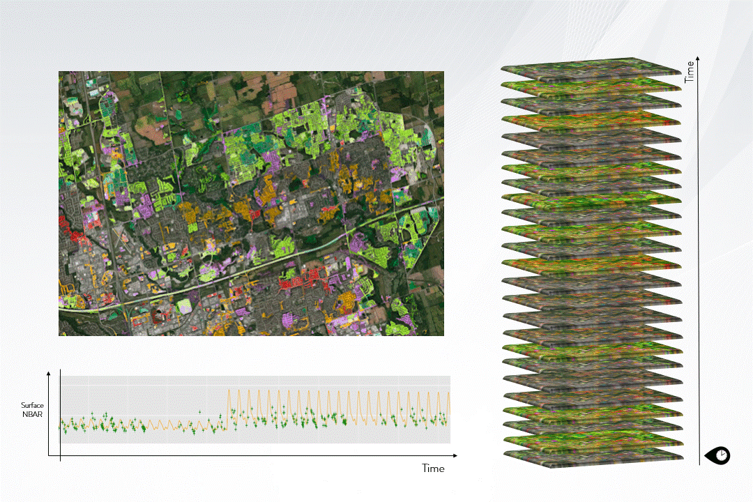
“In my opinion, that’s a big step forward,” Zhu says. “I’m eager to collaborate and eager to help.”
CATALYST is also establishing a Center of Excellence at UConn. The establishment of the Center will help teach students to use the CATALYST Professional software which they will be able to access at no cost.
“The partnership brings together UConn’s research expertise, academic commitment, and an industry at the forefront of innovation,” says Indrajeet Chaubey, dean of the College of Agriculture, Health and Natural Resources. “We’re excited to work together to advance this important research.”
CATALYST has established Centers of Excellence all over the world including the University of Vienna, AGH in Poland, Stellenbosch University in South Africa, and York University in Toronto.
“CATALYST partners with academic organizations globally including UConn to enable scientists to further advance scientific progress in leveraging earth observation to study climate change,” June McAlarey, president and CEO at CATALYST, says. “Exploring time series information derived from satellite imagery can provide insights into our stewardship of the land, and enable better decision making.”
One of CATALYST’s goals is to democratize access to the information their software can provide by making it accessible to those without expertise or the computational power to gather it themselves. Additionally, partnerships with academic institutions give students and researchers access to software to support their work.
This mutually beneficial collaboration will help CATALYST validate their technology and support UConn research by providing the deep capacity necessary to support high-level analyses in remote sensing of global environmental change.
This collaboration will hopefully continue beyond the current research challenge and continue to support innovation in remote sensing and geospatial analyses.
“There are a lot of things we can learn from each other to advance the science of object-based time series analysis for better understanding of where, what, how, and why our planet is changing,” Zhu says.