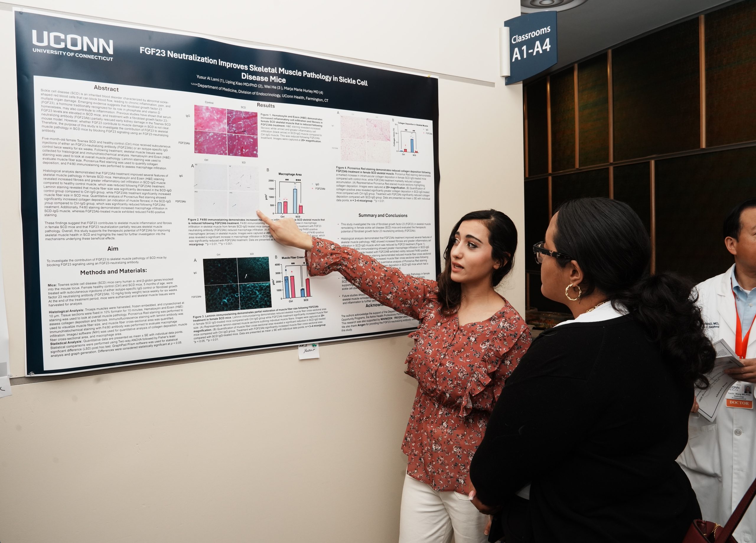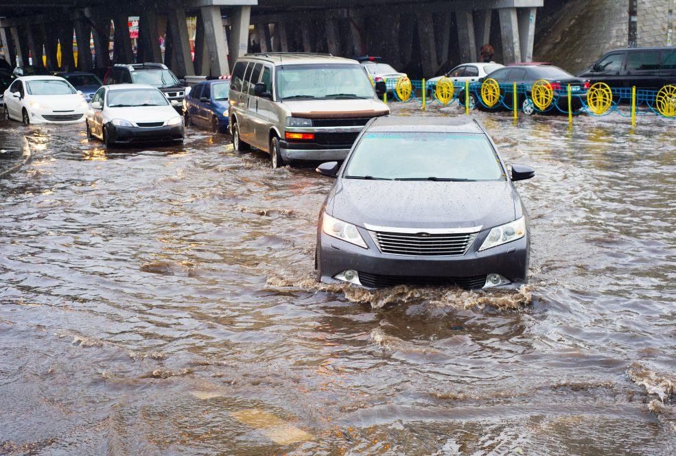
Natural disasters regularly wreak havoc on regions across the globe, and rising sea levels, precipitation changes, and urbanization have only amplified the damage—including right here in Connecticut.
To showcase the impact, UConn Department of Civil and Environmental Engineering Assistant Research Professor Xinyi Shen and Ph.D. student Kang He illustrated the drastic changes in flood risk and severity in the New Haven area at their June 14 Connecticut Institute for Resilience and Climate Adaptation (CIRCA) webinar entitled “Extreme Precipitation and Riverine Flood Risk Analysis.”
Their research uses hydrological and hydraulic modeling of extreme flood events to examine two determinants of flood severity in the area: riverine and storm surge floods. First, they looked at the regional differences in areas affected by coastal compound flooding versus those affected by river/inland flooding. They chose New Haven because it has both coastal areas and inland rivers, like the Quinnipiac River.
“One part of the project is to identify the regions that can be affected by inland river flooding, regions that can be affected by storm surge coastal flooding, and ones that can be affected by both,” says Shen. “With this information, we can determine the risk and possible severity of different flood events.”
The second objective is to look at how an increase in impervious areas, like concrete, affects flooding. Urbanization has led to an increase in impervious surfaces that rainwater can’t penetrate. Soil soaks up water from rain or storm surges, reducing the risk of flooding. But as cityscapes lessen the amount of soil, cities can face faster runoff from rains and, as a result, higher risk or increased severity of flooding, said Shen.
Shen and He compared land use data between 1985 and 2018 to determine the impact. Their comparison showed that if a 1980 flood event occurred in 2018, it could be more severe than if it appeared in 1985, because it would have a larger fast flow due to increased impervious areas.
Shen’s research is a tool to arm cities with the knowledge they need to prepare for natural disasters, which is especially important in Connecticut, which has a relatively high population density and proximity to coastal regions. “It is overall a high flood risk area with high assets, so having flood damage estimation in real or hypothetical scenarios can help policymakers and stakeholders in Connecticut increase their preparedness against these storm surges or river floods,” says Shen.
Shen hopes his research can advise policymakers, stakeholders, and residents in high-risk areas.
“Many circumstances can cause floods in coastal regions, and such risk in the current and future climate conditions is poorly understood,” says Shen. “If residents are shown the predicted damages of potential or incoming events, it could change their attitudes towards risk mitigation such as evacuation and flood insurance purchase and hopefully reduce total damages and support more recovery.”
Shen’s presentation is part of a larger CIRCA summer series on climate change and public policy. Explore the list of future webinars by clicking this link.