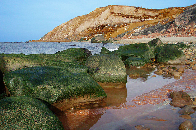
Beachgoers and tourists on Martha’s Vineyard this summer are likely to be thinking more about clambakes than climate change. But the prospect of rising sea levels on the island has absorbed the attention of a geography graduate student.
Jonathan Pollak, who earned a master’s degree in May, wrote his thesis on what would happen on the Vineyard as sea levels and storm surges rise with climate change, and which areas would be most vulnerable, not just physically, but socially and demographically, too.
Using GIS data, Pollak traced the conditions that climate change could cause over the next 40 years or so. A five-meter rise in sea level would inundate large parts of Martha’s Vineyard, he found, and much of the critical infrastructure – roads, police and fire stations, hospitals – would be vulnerable in a storm surge.
So far the sea level rise around Martha’s Vineyard has been modest – two or three millimeters a year – but it is likely to rise faster in the future as glaciers melt and the oceans get warmer and expand, and that poses an important risk for the islands to consider, Pollak says.
Policymakers can make better informed decisions related to adaptation to climate change by using GIS and census data to guide such decisions, he says.
If sea levels were to rise a meter, one percent of Duke’s County (Martha’s Vineyard and Gosnold, the town that covers the Elizabeth Islands) would be under water. But the effect would escalate rapidly if sea levels rose 3 meters: as much as 12 percent of the country would go under.
A 4 meter to 5 meter rise would be catastrophic, he found.
Storm surges also would be more dramatic if sea levels rose. More frequent strong hurricanes and tropical storms are expected with climate change. Pollak’s “worst case scenario” showed 20 percent of the islands being inundated by a Category 4 hurricane. (Katrina, by comparison, was a Category 5 storm.)
The highest elevation on Martha’s Vineyard is about 90 meters. The biggest impact on people of rising sea levels would be in the more touristy lower areas (down island), that are also the most populous –places such as Edgartown, Tisbury, and Oak Bluffs, where infrastructure is located – the airport, seaport, lighthouses, and police and fire stations.
A stronger tidal current in Edgartown harbor would cause problems, and the bridge to Chappaquiddick could complete its disappearing act, already under way.
The more developed areas down island have more people, and residents with low incomes would have fewer resources for coping with changes in housing or transportation. Although property values on the Vineyard can be in the millions, the median income in Duke’s County is well below $100,000, he found.
The affluent tourist trade would also be affected, as well as commercial fishing, the backbones of the area’s economy.
While some coastal communities around the country have developed Climate Action Plans to mitigate the effects of global warming – by reducing greenhouse gas emissions – for instance, planning adaptive measures for vulnerable populations is less common.
Adaption plans could include such things as where to get fresh water, finding ways to cope with land subsidence and storm surges, and making sure that property is insured.
GIS data can show where the vulnerabilities are and help towns develop strategies to manage them.
“It was really rewarding to see it play out geographically, culturally, and socially,” says Pollak. It was just the type of work he wanted to do when he left his job working for a government contractor in the Washington, D.C. area and returned to graduate school.
“I came back to school knowing I wanted to look at human-climate interaction,” he says.
After earning his degree in May, he went to work for the Consortium of Universities for the Advancement of Hydrologic Science Inc., in Medford, Mass., which promotes water research.
As an undergraduate at Mary Washington College, Pollak interned for two summers with the Martha’s Vineyard Commission, a regional planning group. He updated the GIS data on transportation networks and roads, including the island’s many unlabeled roads.
Read or listen to this blog about Pollak’s research, and connect to maps and more information: http://outsidetheneatline.blogspot.com/2012/06/using-gis-to-evaluate-vulnerability-to.html


