Chandi Witharana is an assistant research professor in the Department of Natural Resources and the Environment (NRE) in the College of Agriculture, Health and Natural Resources. He conducts research in, and teaches, remote sensing, the use of satellite imaging at different electromagnetic wavelengths to map the surface of the Earth.
Witharana has used remote sensing to study, among other subjects, changing permafrost conditions in the Arctic and the size of refugee populations in conflict areas. He also shares his work directly with the public. For instance, he curated an exhibit of satellite imagery entitled Earth as Art, which has been on display at UConn’s Metanoia on the Environment, at GIS Day at the Hartford Public Library, and at the Connecticut Conference on Natural Resources.
From the titles of his courses, such as Remote Sensing Imaging Processing or Object-Based Image Analysis for Remote Sensing, one might get the idea that students learn just the techniques of remote imaging. But Witharana’s classes are about more than that. Students learn to consider the stories behind the images, including those of political issues to environmental devastation to humanitarian crises and how, in response, remote sensing can be used for the global good.
Witharana traces the origins of remote sensing to the 1970s, when NASA began collecting the first multispectral images of the planet. At UConn, remote sensing has a long history. NRE’s Laboratory for Earth Resources Information Systems, the hub for remote sensing research in Connecticut, got its start in 1982.
In the past, says Witharana, many remote sensing classes focused on local applications of imaging technologies. “We used to teach these courses very traditionally, where the goal was often to use remote sensing to map X and Y, such as a forest or a piece of agricultural land.” In his classes, Witharana aims to broaden the perspective of students. He believes that the duty of remote sensors is not just to map the environment, but about record how humans exploit the environment and what effects that exploitation has on human populations.
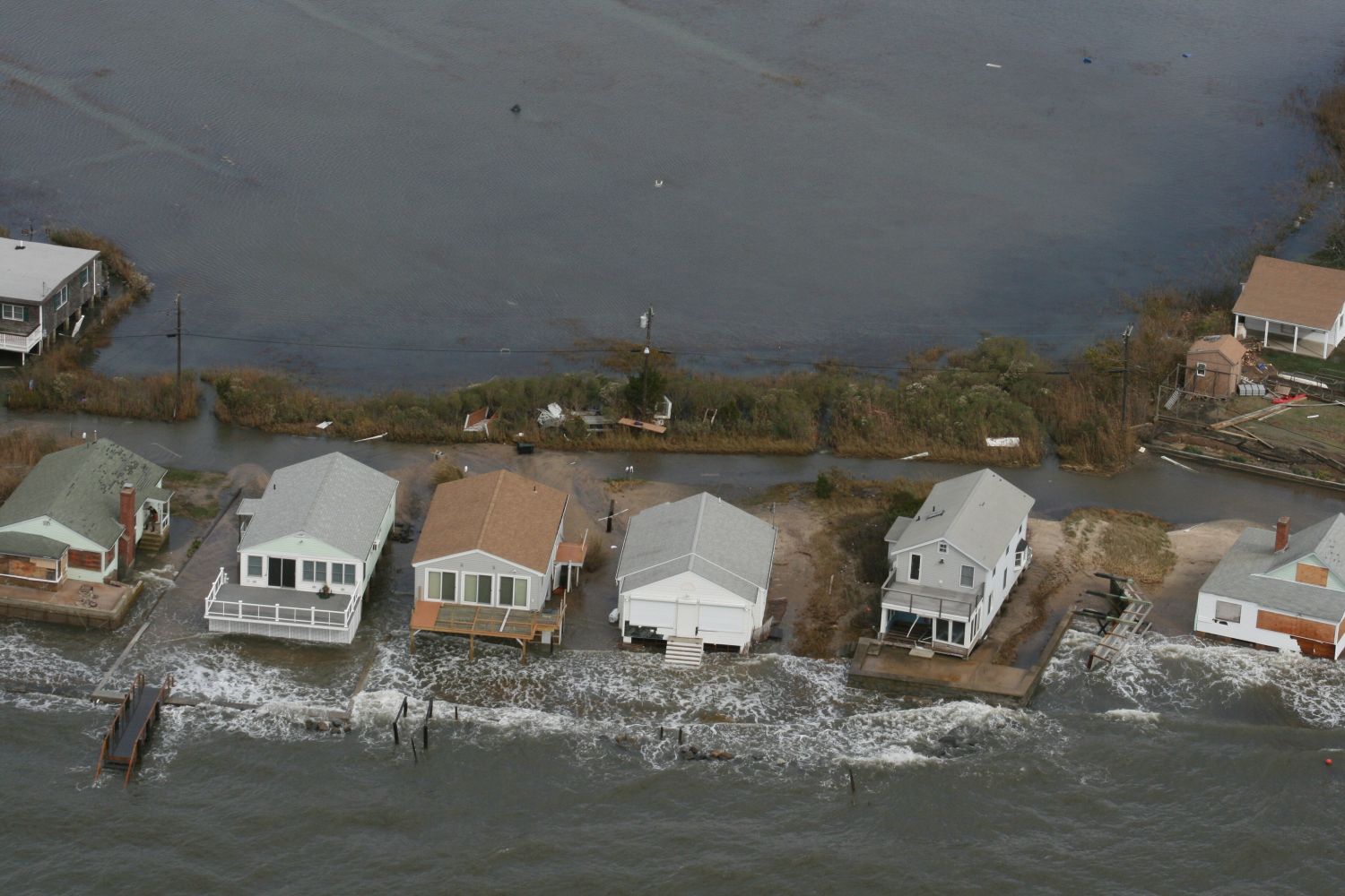
For example, Witharana talks to his students about the stripping off of rainforests in Indonesia to make way for palm oil plantations. In Indonesia and other places, deforestations often take place in remote locations that are hard to access or gather information from. That’s where remote sensing comes in. Remote images show the scope of deforestation and help raise awareness about it.
Witharana teaches his students how remote sensors can play a direct role in helping provide relief for populations in need. In conflict areas, for instance, the needs of refugee populations can change from day to day. Remote sensing images of the location and size of refugee populations are often the only source of objective and timely data and are much more useful in preparing to provide for basic needs than delayed or inaccurate reports from the ground.
This humanitarian application of remote sensing is relevant to students studying natural resources because, Witharana explains, many humanitarian crises result from conflicts that have roots in natural resources: “People are fighting for water, land or some other geopolitical resource.”
One of Witharana’s goals in the classroom is to create an environment of accessibility for his students. He says his inspiration to become a teacher arose from his own lack of access to information as an undergraduate. As a geology major, Witharana wanted to learn more about remote sensing, but courses on the subject were rare at his university. When a visiting professor finally did start teaching remote sensing, Witharana found that he was practically unreachable. Witharana recalls going to his office day after day to ask him questions about remote sensing and being turned away: “When I went to him, he said ‘come another day,’ ‘come another day’.”
The experience inspired Witharana to become a teacher who could not only impart to his students the information they need learn, but one who is readily accessible to all his students.
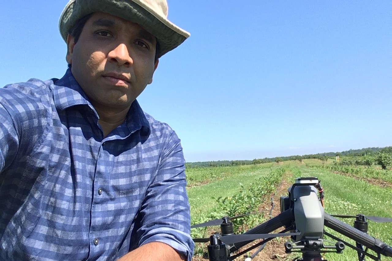
Witharana believes that a hands-on approach is the best way to teach. He believes that most knowledge “comes through fingers rather than through eyes.” When students are learning the techniques of satellite imagery, Witharana has them use a drone to take photos of campus, then explains how the mechanics of drone imagery are similar to the mechanics of satellite imagery.
Witharana’s passion for teaching extends beyond the UConn campus. He has taught remote sensing to K–12 students and received grants to implement remote sensing lessons in K–12 classrooms in Connecticut. He says he enjoys teaching K–12 students, not least because many students are already so familiar with technology. He encourages other faculty to take part in K–12 programs too.
Witharana hopes that his students learn from his courses that global events and processes, such as climate change, often have local effects. He says, “I want them to know that if something is happening somewhere, it could have an impact on their neighborhood.”