Predicting how water moves through coastal structures, while also accounting for the complex variables that impact the movement, takes a lot of computational power and expertise. But that information is vital for municipal planning, especially when contending with sea level rise and increasingly strong coastal storms.
Yan Jia, a research associate at UConn’s Connecticut Institute for Resilience & Climate Adaptation (CIRCA), has made this process much easier and quicker, cutting the calculation time from hours to minutes and eliminating the need for supercomputers.
The East Coast is home to many inlets that control tides moving inland into coastal marshes, and Jia and his team have been working to learn more about how water moves through these key structures. This research is the focus of Jia’s CIRCA webinar talk, part of the Resilient Connecticut June 2021 Research Webinar Series.
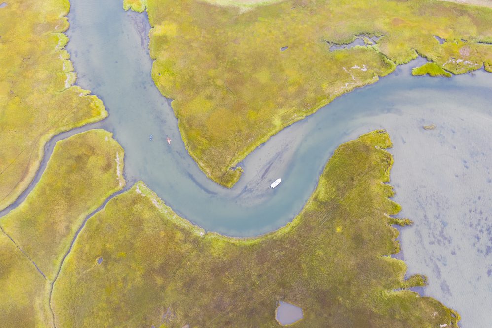
The inlet used for the analysis is in Guilford. It measures only about 16 feet across, Jia explains, and is the source of water for a salt marsh that comprises approximately 230 acres.
“We want to know about the daily routines of the water moving through these narrow inlets and study impacts on chemical or biological process with the water circulation,” Jia says. “We also want to know what happens during storm surges, hurricanes, or Nor’easters. How bad is the flooding especially considering sea level rise?”
Jia explains this salt marsh was chosen because it floods frequently, along with a road that transects the marsh. The road was built around 90 years ago, and due to sea level rise, the flooding has become increasingly problematic within the past 10 years, says Jia, prompting residents to apply to build a new bridge projected to cost millions of dollars.
“During ebb tides, the salt marsh is totally dried out,” Jia says. “During flooding tides where the water is low in the marsh, the current going into the marsh through the inlet is very strong. We want to know more details and how important the inlet structure is in controlling the water circulation.”
After taking measurements, Jia determined the inlet was imparting strong control over water circulation for the whole saltmarsh. The research performed some model simulations to see how well they could reproduce the phenomena.
To do this, Jia says, they started from computer simulations.
“To run the simulation, we created an idealized domain, like a perfect swimming pool, with two jetties forming an inlet in the middle. Then, we force tides through the inlet to simulate the water dynamics as the water flows through the structure. Then it simply becomes F=ma, Newton’s Second Law,” says Jia. “That’s the same principle of how the weather forecast or hydrodynamic modeling works.”
The computer simulations help identify the key terms in momentum balance; in other words, what causes the flow constraint at the inlet.
It is also novel, says Jia. Within the inlet, there is a pressure gradient force caused by the different water levels between the open water and the salt marsh. Referring again to Newton’s Second Law, Jia explains the forces will balance one another and in this case the balance is struck by horizontal mixing caused by lateral shearing originating from the banks of the inlet.
“This is kind of a new discovery in our area of study, because in normal oceanographic modeling, this horizontal eddy viscosity is really small — it should be near zero,” Jia says. “In this case, it became important because we studied a fine structure scaled in meters. In physical oceanography modeling, usually the grid size is much greater, from 100 meters in estuaries to kilometers in deep ocean. With the greater resolution, it’s quite a different picture.”
Furthermore, based on the momentum balance from the numerical simulation, Jia built a quick but easy model to predict the water level, meaning it can be run daily for prediction or planning purposes.
“Using a normal numerical model takes maybe one to two hours on a supercomputer with 64 central processing units to finish one simulation, but with this new model you can finish in less than one minute because we simplified the simulation from two-dimensional to two points. It is more computationally efficient and easy to handle.”


