Connecticut is experiencing hotter days and nights, and the warming trend is expected to continue in the coming years with larger cities bearing the brunt of heat stress.
Now is the time to prepare and Connecticut Institute for Resilience and Climate Adaptation (CIRCA) researchers Assistant Director of Research Yaprak Onat and Legal Policy Fellow Louanne Cooley ‘20 JD are partnering with the City of Norwalk to monitor heat to inform public health responses and direct policy tools for building safer and more resilient communities.
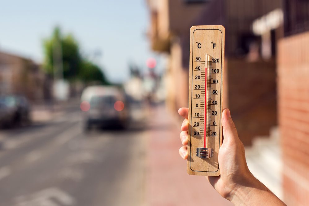
Heat and humidity are a deadly combination. When conditions are hot, we sweat, and the process of that sweat evaporating cools us down. However, when humidity rises, the air reaches a point when it is too saturated, evaporation can no longer occur, and our bodies are unable to cool themselves.
The City of Norwalk’s Health Department Public Health Program Associate, Aniella Fignon ‘20 JD, MPH, explains this is the reason why a temperature that wouldn’t be considered hot or extreme can sometimes put people at risk for heat-related illness or death.
“For example, an 85-degree Fahrenheit day could put a person at risk of sunstroke with only 65% humidity, and that’s not including [a] potential additional 15 degrees due to sunshine exposure,” Fignon says. “A 70-degree day with 65% humidity could put somebody at risk of some sort of heat exhaustion or heat illness.”
These are troubling details considering that Connecticut is expected to experience an increase in average annual temperatures and more heat waves as we near 2050.
Finding the places where heat is likely to be felt the most
Heat is an even bigger issue for cities, which are full of pavement, asphalt, and other surfaces that absorb and hold heat leading to what is called the “urban heat island effect” making cities around 5 degrees warmer during the day and as much as 22 degrees warmer at night compared to less densely populated areas.
What we don’t know is exactly where within the cities the heat is the worst, what kind of environmental conditions and landscape structures are around in that area, and who is being impacted by these factors says Onat:
“What kinds of communities are bearing the brunt of these burdens with extreme climate change conditions? We are trying to associate different landscape varieties and different neighborhood statistics to the kinds of heat stress experienced within these neighborhoods so that we can make meaningful sense and then identify what needs to be done for resilience.”
CIRCA and the City of Norwalk’s Planning and Zoning Department initially began to discuss the potential for this project in late 2021, and by 2022 an interdepartmental team was established to identify potential locations where they could install sensors to track the heat.
In June of this year, sensors were placed around Norwalk on poles or in trees, eight to 10 feet from the ground to capture data from a variety of scenarios.
“We identified locations for Norwalk that have pavement scattered over three areas, large high-rise buildings, open low-rise buildings, industrial areas, and the list goes on. It was a collaborative effort to select 13 locations,” Onat says.
The project will help the city focus on the intersection of climate change, social inequities, and health, and find ways to address health inequities that disproportionately impact communities of color and low-income communities, says Fignon.
“It’s important that we evaluate these threats by collecting data to inform public health resilience, planning, and resilience responses. We have a lot of preparation to do starting now, and this research will help the city address climate change by informing public health and community planning decisions.”
Over the months of data collection, researchers saw higher heat, characteristics in certain landscapes, and variations in areas with certain demographic or population characteristics, and also what people in those areas were experiencing while doing various activities.
“For example, a sensor was placed on top of a batting cage for an elementary school, so we could gauge what kids were feeling,” Onat says. “We also had one in the shade where people might be going to a picnic or using the trails.”
Fignon is excited about what the data will inform, from strengthening and developing policies to protect people, to enhancing existing programs and developing new ones, and shaping public education opportunities.
“We have asphalt all over our city, we have pavement all over our city. We could be planting trees, and this data is helping us to focus on the hotspots within the city that is almost entirely covered in pavement anyways, but where are the hottest spots? Where should we be placing cooling centers?”
A toolkit for local adaptation
To help municipalities build resilience, the legal team at CIRCA has developed a resilient zoning toolkit with measures that are within the existing legal authority, says Cooley.
“We need to pursue longer-term mitigation strategies like increasing energy efficiency, reducing vehicle miles traveled, increasing renewable energy, and incentivizing electrification,” she says.
At the same time, Cooley says, cities and citizens need to think about how to adapt.
One of the most effective ways to combat heat is by increasing the tree cover of what are known as vegetative protective zones. Municipalities can adopt tree ordinances to help manage public trees, as the shade that trees produce has a huge impact on localized heat. Towns also have plans for conservation and development, which can include guidance on improving community infrastructure, and preserving natural spaces, it could include plans for addressing excessive heat.
“Regulations about landscaping, trees, and green spaces are great at ameliorating increasing heat because they create shade, keep the area under them from heating and retaining heat, and disrupt the wind and hold in soil moisture,” Cooley says. “Zoning regulations can be used to mandate tree planting, maintenance, and care including what kinds of trees are used in what locations so that there is a good match for the area and to increase tree survivability.”
There are other legal or policy tools that towns can use, including building codes, says Cooley. Municipalities can implement strategic land use planning and zoning regulations to improve local climate adaptation and resilience. Zoning can also be used to address heating through regulations on reflective surfaces or using light-colored materials that absorb less heat.
“Zoning is only one tool, and it’s forward-looking, we make changes to zoning codes today, but the impact of those changes won’t be felt immediately, but in combination with a broad response to the challenges of increasing heat, zoning can be a powerful tool, our climate is going to continue to warm, and we will need to continue to limit greenhouse gases and use all the tools available to meet the immediate and long term needs of people to adapt to increasing heat,” Cooley says.
The data gathered by researchers can help municipalities direct their resources to where they’re most needed, Cooley says.
“Yes, heat is a problem, and we can show you where. Public health departments can use this information to create a smart response to the immediate need, develop policy, and work with zoning officials to create resilient design standards to incentivize strategies that will help ameliorate the impact of increasing heat.”
If you are interested in connecting with CIRCA to place sensors to gather heat information in your community, reach out to circa@uconn.edu or yaprak.onat@uconn.edu