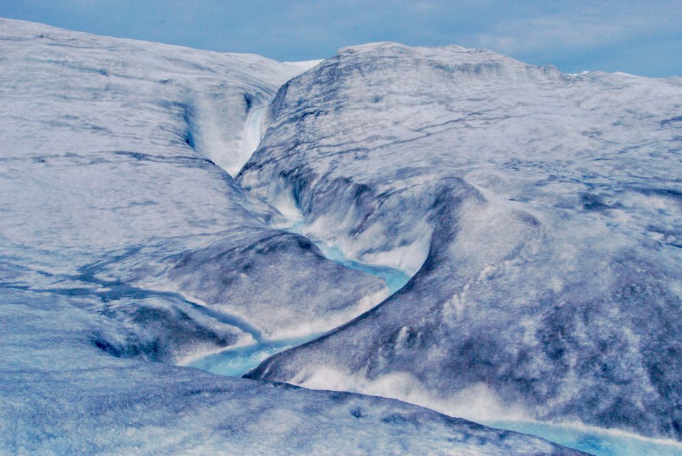
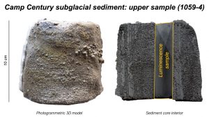
During the Cold War, a secret U.S. Army mission, at Camp Century in northwestern Greenland, drilled down through 4,560 feet of ice on the frozen island—and then kept drilling, to pull out a 12-foot-long tube of soil and rock from below the ice. Then this icy sediment was lost in a freezer for decades. It was accidentally rediscovered in 2017 and shown to hold not just sediment but also leaves and moss, remnants of an ice-free landscape, perhaps a boreal forest.
But how long ago were those plants growing in an area that today is an ice sheet two miles thick and three times the size of Texas?
An international team of scientists, including UConn Earth Sciences Associate Professor Julie Fosdick, was amazed to discover that Greenland was a truly green land only 416,000 years ago (give or take about 38,000 years).
Their new study was published Thursday, July 20 in the journal Science.
‘Bulletproof Evidence’
Until recently, geologists believed that Greenland was a fortress of ice, mostly unmelted for millions of years. But, two years ago, using the rediscovered Camp Century ice core, this team of scientists showed that it likely melted less than one million years ago. Other scientists, working in central Greenland, gathered data showing the ice there melted at least once in the last 1.1 million years—but until this study, no one knew exactly when the ice was gone.
Now, using advanced luminescence technology and rare isotope analysis, the team has created a starker picture: large portions of Greenland’s ice sheet melted much more recently than a million years ago. The new study presents direct evidence that sediment just beneath the ice sheet was deposited by flowing water in an ice-free environment during a moderate warming period called Marine Isotope Stage 11, roughly from 424,000 to 374,000 years ago. This melting caused at least five feet of sea level rise around the globe, and potentially as much as 20 feet, says Fosdick.
“It’s really the first bulletproof evidence that much of the Greenland ice sheet vanished when it got warm,” says University of Vermont geoscientist Paul Bierman, who co-led the new study with lead author Drew Christ, a post-doctoral geoscientist who worked in Bierman’s lab, Professor Tammy Rittenour from Utah State University, and 18 other scientists from around the world.
Understanding Greenland’s past is critical for predicting how its giant ice sheet will respond to climate warming in the future and how quickly it will melt. Since about 23 feet of sea-level rise is tied up in Greenland’s ice, every coastal region in the world is at risk. The new study provides strong and precise evidence that Greenland is more sensitive to climate change than previously understood—and at grave risk of irreversibly melting off.
“Greenland’s past, preserved in 12 feet of frozen soil, suggests a warm, wet, and largely ice-free future for planet Earth,” says Bierman, “unless we can dramatically lower the concentration of carbon dioxide in the atmosphere.”
Into the Light
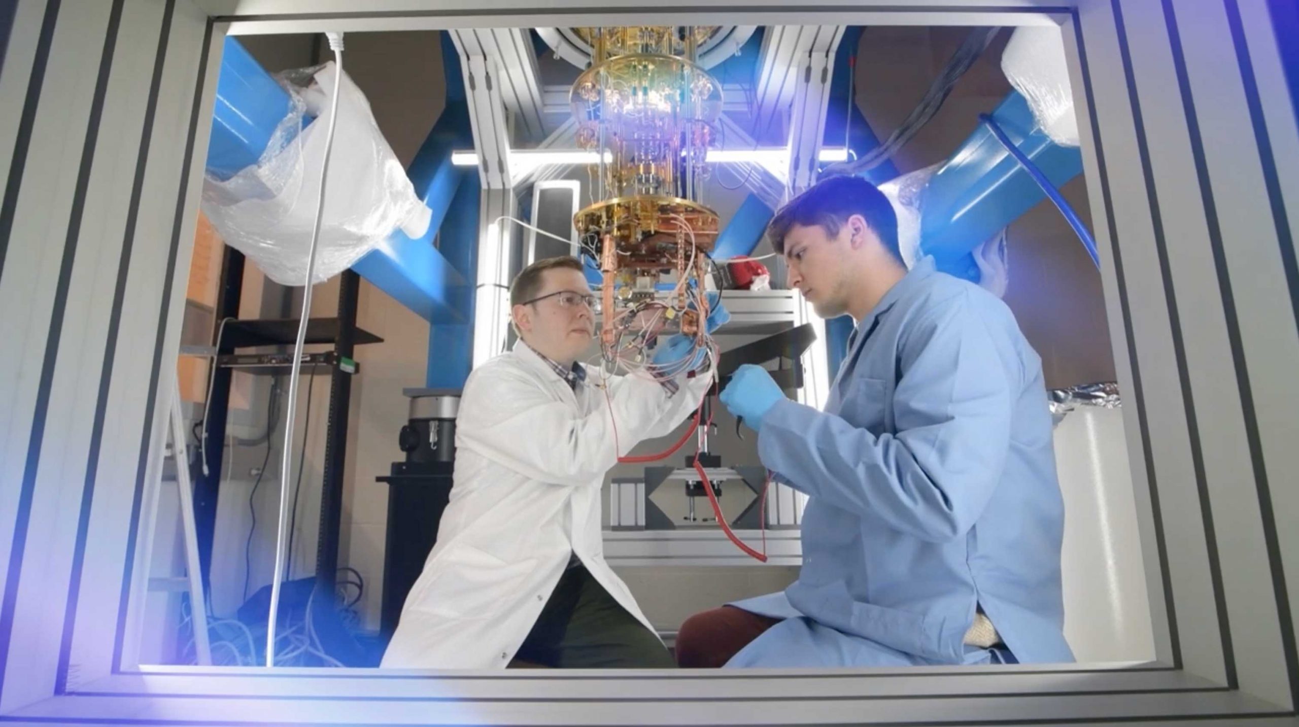
At Rittenour’s lab, sediment from the Camp Century core was examined for what is called a “luminescence signal.” As bits of rock and sand are transported by wind or water, they can be exposed to sunlight—which, basically, zeros out any previous luminescence signal—and then re-buried under rock or ice. In the darkness, over time, minerals of quartz and feldspar in the sediment accumulate freed electrons in their crystals. In a specialized dark room, Rittenour’s team took pieces of the ice core sediment and exposed them to blue-green or infrared light, releasing the trapped electrons. With some advanced tools and measures, and many repeated tests, the number of released electrons forms a kind of clock, revealing with precision the last time these sediments were exposed to the sun.
These powerful new data were combined with insight from Bierman’s UVM lab. There, scientists study quartz from the Camp Century core. Inside this quartz, rare forms—called isotopes—of the elements beryllium and aluminum build up when the ground is exposed to the sky and can be hit by cosmic rays. Looking at ratios of beryllium and other isotopes gave the scientists a window into how long rocks at the surface were exposed vs. buried under layers of ice. This data helped the scientists show that the Camp Century sediment was exposed to the sky less than 14,000 years before it was deposited under the ice, narrowing down the time window when that portion of Greenland must have been ice-free.
Further evidence came from Fosdick’s research group, the Basin Analysis & Helium Thermochronology Lab at UConn, which led to the understanding of where the sediments came from through helium isotope analysis,
“We collect helium isotopes from the sediment that allow us to figure out how quickly or slowly those different sediments were eroded from the ancient Greenland hillslopes,” Fosdick says. “Our apatite tracer thermochronology data capture sources across a slowly eroding landscape within Archean crust.”
Fosdick explains that being able to assess the provenance, or source, of sediments is key because the sediments capture a picture of surface drainage across the northwestern Greenland landscape during this ice-free time. Now, most of Greenland is covered in ice, so there is very limited information on the geology underneath.
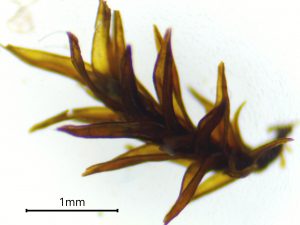
“We’ve reconstructed what looks to be a vegetated and ice-free stream system, with flowing surface waters that existed 416,000 years ago,” Fosdick says.
Sea Level
Camp Century is 138 miles inland from the coast and only 800 miles from the North Pole; the new study shows that the region entirely melted and was covered with vegetation during Marine Isotope Stage 11, a long interglacial period with temperatures similar to, or slightly warmer than, today. With this information, the team’s models show that, during that period, the ice sheet melted enough to cause at least five feet, and perhaps as much as 20 feet, of sea-level rise. The research, supported by the U.S. National Science Foundation, lines up with findings from two other ice cores collected in 1990s from the center of Greenland. Sediment from these cores also suggests that the giant ice sheet melted in the recent geologic past. The combination of these earlier cores with the new insight from Camp Century reveal the fragile nature of the entire Greenland ice sheet—in the past (at 280 parts per million of atmospheric CO2 or less) and today (422 ppm and rising).
Fosdick says the data gives us valuable information for understanding the risks of future Greenland ice sheet melting and sea level rise in response to climate change today.
“The CO2 levels during Marine Isotope Stage 11 interglacial were lower than today, but warming was still sufficient to generate major Greenland ice sheet melting.”
“If we melt just portions of the Greenland ice sheet, the sea level rises dramatically,” says Rittenour. “Forward modeling the rates of melt, and the response to high carbon dioxide, we are looking at meters of sea level rise, probably tens of meters. And then look at the elevation of New York City, Boston, Miami, Amsterdam. Look at India and Africa—most global population centers are near sea level.”
“Four-hundred-thousand years ago there were no cities on the coast,” says Bierman, “and now there are cities on the coast.”