In August and October of 2023 a team of researchers supported by the International Ocean Discovery Program (IODP) traveled aboard the JOIDES Resolution, a massive drilling ship, to the coast of Greenland to drill deep down into the muddy seabed seeking information to fill knowledge gaps about the region’s glacial history. Professor and Head of UConn’s Department of Earth Sciences Tracy Frank is one of the researchers who helped gather samples and is now using the miles and miles of muddy cores to reconstruct the past to help inform the future as the ice sheet melts.
Frank says ocean sediments are probably the best archive of Earth’s climate and the specialized drilling equipment on board the JOIDES Resolution makes this work possible.
“The JOIDES Resolution has traveled the world for different research projects, obtaining cores to answer questions about how the oceans formed and about Earth’s climate history,” says Frank. “The deepest core we drilled was over a kilometer – over half a mile – deep.”
They traveled to different sites in Baffin Bay along the Northwest Greenland Glaciated Margin, where the seafloor sediment was of known ages, to study the dynamics of the Greenland Ice Sheet. Understanding these dynamics is vital, says Frank, because the melting of the Greenland Ice Sheet could contribute up to 21 meters of sea level rise.
“We are hoping to get a history going back about 30 million years to try and understand when the ice sheet that we know today formed and how dynamic it has been so that we can get a sense of how it might respond to current climate change.”
The drilling took place directly offshore in areas where the Greenland Ice Sheet is known to have expanded and contracted over the years.
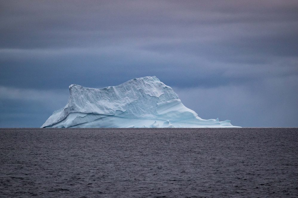
Frank explains that in the formation of the ice sheets, the ice picks up debris. During warmer periods when the ice sheet melts, icebergs calve off and float out to sea, melting along the way and depositing their debris on the seafloor. This “ice-rafted debris” is characteristically larger than debris deposited by other processes, like rivers, which carry finer silt.
Knowing the differences in how materials are deposited on the seafloor, either by ice or by flowing water, researchers can glean clues about the region’s environment and climate. The researchers can also use things like fossil plankton to determine whether there was sea ice or if it was too warm.
“In deep water like where we were drilling, the only sediment that tends to accumulate is very fine-grained, but if you have big chunks of granite, for example, it’s a good clue that there was an ice sheet around. We were drilling near one of the big glacier outlets. We saw some cool stuff; for example, in the period that predated the presence of a large ice sheet, we found wood fragments and things like that in the core. This material would be carried to the coast by rivers and then carried out to sea. We found the remains of the last forests in Greenland, which is cool.”
An aspect of the program that Frank appreciates is that it brings together scientists from all over the world with a variety of expertise, from geochemistry to sedimentology, paleontology, geophysics, and paleomagnetism.
“I was on the biggest team, which was the core description team. We were describing all of the cores and making some basic interpretations about the depositional environment.”
Frank explains that they drilled seven sites, targeting sediments of a certain age. Drilling operated 24/7 with the help of a team of drillers working on the drill rig doing their best to obtain good material for the researchers. The drilling would happen about 10 meters of core at a time, drilling deeper.
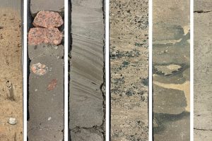
“When a core was brought on deck it would go through a flow where it was examined by the different science groups. It was very hectic. There were night shift and day shift teams, so that we could continue the work over 24 hours a day. I was on the night shift, working midnight to noon. We do have a pretty good sense of the record that we recovered, but over the next two years, everyone’s going to go into more detail. Some people are going to focus on really refining an age model for the material. Others are going to be looking at climate signatures, while others are looking at the physical processes of sedimentation. We have a whole bunch of different objectives that that people are working on.”
After the cores were collected, Frank says they were shipped to an international repository in Germany which acts like a drill core library, where they will be available for research for years to come.
Once the samples were collected, the researchers started planning their studies. In March, Frank traveled to Germany to help in the immense effort of taking detailed, to-the-centimeter, samples from the miles of core collected. Since each layer represents a slice of time that yields clues about the conditions, the measurements and samples must be precise.
“We had a big patchwork of samples for different projects, and it was like a factory assembly where we had a database that says, ‘Okay, this researcher needs this sample from this interval’. Then we scooped out the sample. It was like a big complicated, data buffet.”
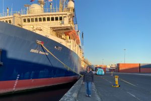
Unfortunately, this was one of the last cruises for the JOIDES Resolution, says Frank, since the NSF has declined to continue funding the ship after 2024.
“The program has contributed massively to our understanding of Earth’s climate history, but they made that decision because of budget issues, and it looks like the future is uncertain.”
The ship has played an important role in understanding our uncertain future because the melting of the Greenland Ice Sheet will bring great changes globally, and learning as much as we can about its past will help us anticipate the future says Frank,
“We don’t know when, how fast, or how much the ice sheet will melt. That’s one of the questions we’re hoping to answer with the cores.”
