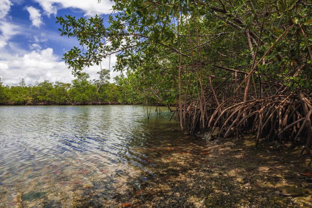
Mangroves are remarkable ecosystems home to amazing biodiversity, dense vegetation, and conditions that capture large quantities of carbon. Since they occur in warm, tropical, and subtropical coastal regions, they also take the brunt of the impact from hurricanes and cyclones and are therefore important for coastal protection. Though they can recover naturally, repeated storms can hinder or halt their recovery, resulting in dead mangroves called “ghost forests.”
To help combat the loss of these vital ecosystems, researchers from UConn’s Global Environmental Remote Sensing (GERS) lab are working to comprehensively monitor the health of mangroves. Their recent study published in Remote Sensing of Environment focuses on mangroves in Florida to see which areas cope with increasingly intense and frequent hurricanes and which mangroves may be at greater risk of being wiped out completely.
Lead author and Postdoctoral Researcher Xiucheng Yang says that, thanks to remote sensing technology, decades of mangrove images are available, including images taken after disturbances like hurricanes.
“After the disturbance, we can continuously track mangrove conditions, to see what happens due to extreme weather events and the ongoing recovery process of the damaged mangrove,” says Yang. “We wondered if we could use this data to predict which mangroves could recover or not.”
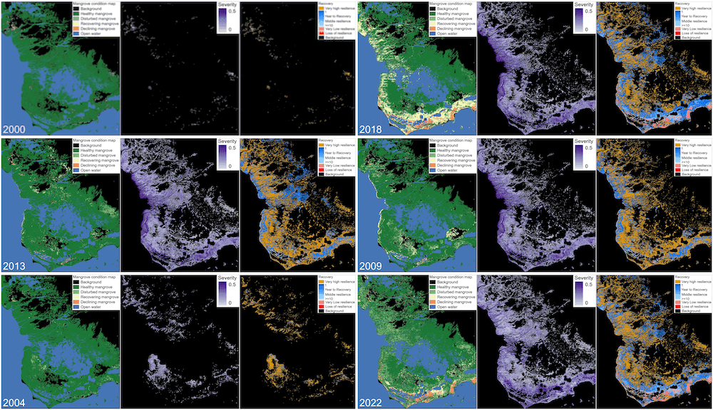
To see if this was possible, Yang and the GERS team paired a dense Landsat time series with a disturbance detection algorithm they developed previously called DEtection and Characterization Of the tiDal wEtland change (DECODE). They went a step further and included the element of Recovery and Resilience to automatically monitor mangrove conditions, in a method called DECODER.
The study focused on Florida, since those coastlines are home to an estimated 96% of mangroves in the United States. Florida’s mangroves are also under growing pressure, with increasingly frequent and powerful hurricanes. Using this method, the researchers mapped mangrove conditions and tracked the trajectories of recovery between the years 2000 to 2022 with an overall accuracy of over 97%.

Department of Natural Resources and the Environment Associate Professor and GERS Lab Director Zhe Zhu explains that monitoring recovery is an important element as some mangroves recover naturally from disturbances while others decline, and some decline worse than others. By tracking the conditions over time using DECODER, the researchers hope to predict which areas are at greatest risk, to help pinpoint mangroves in need of intervention.
“We can provide critical information to identify hotspots for recovery and restoration efforts,” says Yang. “Previously, researchers could only produce a binary map showing mangroves as present or absent. Our dense time series approach goes beyond simple distribution, offering insights into the dynamic health conditions of mangroves, especially their recovery processes following extreme weather events. This capability is unique.”
Yang explains that their method differentiates mangrove responses to disturbance, categorizing them as healthy, disturbed, recovering, or declining.
“High severity doesn’t necessarily mean that a mangrove’s recovery ability is compromised. Some highly affected areas can still recover naturally, while others may struggle. That’s why we not only assess the immediate severity of events but also estimate the potential and pace of recovery,” Yang adds. “For some areas, we indicate that without human intervention, mangroves may either never recover or recover very slowly.”
This data is important because it can be used to direct restoration efforts to the areas that need it most. Zhu says that another important question they hope to address is how resilient mangroves are.
“Mangroves are like armor to protect us from climate change, but faced with sea level rise and extreme weather, will these important habitats still be available to protect us? Are they resilient enough?” asks Zhu. “That’s a question everybody wants answered, but how do you measure that on the ground? By using these past disturbances to observe recovery, that’s one way to answer that question. This is where the ‘R’ in DECODER comes in,” says Zhu. “How many years does it take for an area to recover to its previous state? And the quicker it can recover, the more resilient it is. In a sense, we are using nature to help test their resilience, which areas are more resilient and why? That information will also help recovery efforts make the mangroves more resilient.”
This use of technology is an example of how humans can work with nature to build resilience in the face of climate change. The GERS lab has plans to apply the DECODER method broadly to aid in mangrove mapping and restoration efforts globally.
This study was supported by the USGS Land Management Research Program and North Atlantic Coast Cooperative Ecosystem Studies Unit (CESU) Program for “Detection and Characterization of Coastal Tidal Wetland Change (G19AC00354)” and “A Sample-based Approach for Analyzing the Driver of Coastal Tidal Wetland Changes (G23AC00410)”, US Fish and Wildlife Service Program for “Evaluating Coastal Tidal Wetland Change in the Conterminous United States (F22AP02176)”, USGS Coastal & Marine Hazards and Resources Program, and NASA Carbon Monitoring System Program for “An Alkalinity and Inorganic Blue Carbon Monitoring System: Crediting Wetland-to-Ocean Lateral Fluxes in Carbon Markets”.


