New England’s expanse of stone walls is not only picturesque: each wall contains a rich history about the region’s geological past and insights about those who placed each stone.
Department of Earth Sciences Professor Robert Thorson has worked for decades to tell these stories and build an appreciation for these historical structures, but he says we need a systematic and methodical way to collect and catalog the information to effectively manage and conserve these emblematic features of the landscape.
In a paper published in The Public Historian, Thorson presents the case for conservation based on scenic, legal, historic, ecologic, and Indigenous values, and lays out a stepwise plan for effective management to ensure stone walls are preserved.
The Plan for Conservation
After advocating for stone walls for many years, including writing books and articles, and giving over a thousand talks on the subject, Thorson says, “I asked myself, ‘Why am I doing all of this work for conservation if we do not have a methodological or rational approach?’ I see a very clear parallel to managing stone walls the same way we did with wetlands conservation.”
This inspired Thorson to develop a plan to bridge this gap. His plan starts with engaging the community to ensure that everyone involved with the project understands and appreciates the importance of preserving relics of local and regional history.
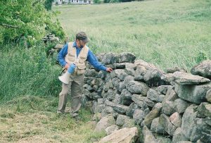
The next step is locating and mapping the sprawling networks of stone walls across whatever jurisdiction is involved, whether private, town, state, federal, or Indigenous. Using Geographic Information System (GIS) software, Thorson says entities can create a layer and database for the stone domain, just as they do for wetlands, zoning, emergencies, or parks. Using a top-down approach, they can implement the new technology of light detection and ranging technology (LiDAR), to locate potential sites for ground-truthing. From the bottom up, they can import whatever information is already available, for example, inventories from historical commissions and land trusts.
The next steps involve on-the-ground, inventory, cataloging, and classifying of each wall and related object using a taxonomy—or systematic method of naming—developed by Thorson.
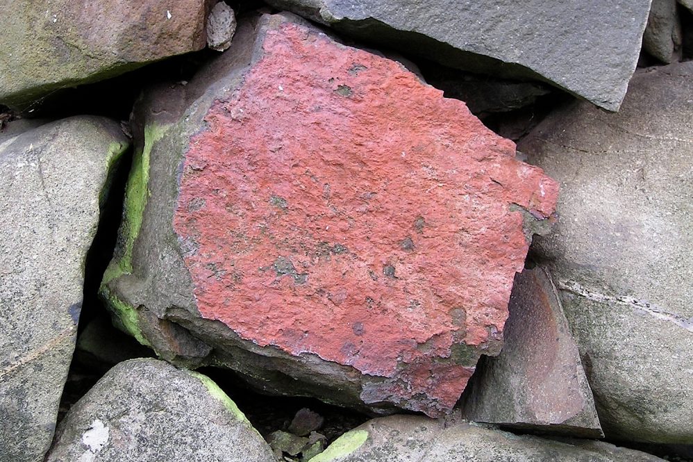
Description comes next, which Thorson says reveals information not found in any other data source, but the stone walls themselves; for example, their construction methods, types of stone, and idiosyncratic folk art. An example of difference in context includes the layouts of walls across the landscape in New Hampshire compared to Connecticut. The regions have distinct patterns, Thorson says, due to later and earlier settlement patterns.
An important next step is to determine where the stone walls lie in relation to current property lines. Whether public or private, this will dictate what conservation measures can be taken. Management is the following step in Thorson’s plan, which he says will vary case by case. The final step is interpretation, which culminates in integrating the information, now centrally gathered, and sharing the findings with the public. This can happen through talks, walks, field trips, websites, curricula, and many other types of public programming to share what stories unfold.
The Stories Waiting to be Told
The result of the plan is the public would essentially have a library of stone stories for each wall available. For example, we can learn more about the largely lost history of ordinary individuals who tossed or placed each stone by hand as they worked land, often humorously described as containing more rocks than dirt.
“Ultimately the goal is storytelling, using a source of information that is independent of conventional history,” Thorson says.
Thorson also hopes to convey that anyone can learn how to interpret the wealth of information from the walls. One can begin scratching the surface by looking at the stones themselves. For example, the familiar rounded gray stones are glacially milled fragments of granite that reveal a story of past climate change. And those with drilled holes can help date a wall, based on technology.
The structure of the walls reveals more details. As farmers “made land” they stacked the plentiful waste stones at the periphery of their fields, sometimes more haphazardly. During the laborious initial clearing to establish a farm, many were placed by the less experienced hands of younger helpers. Those of later years, may reveal the techniques of a master mason.
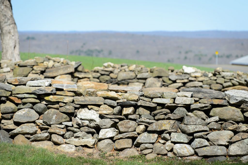
“For example, a sprawling band is a pioneering wall, and a well-built double wall with a capstone says something different from a moderately built one without a capstone, which tells you something differently from a single wall that’s just your basic triangular shape,” says Thorson. “Farmers, would toss stones that would become a pasture wall.”
Later, perhaps as the farm was more well-established and they are past the point of barely surviving, a farmer may have had more opportunities to take the time to build a more deliberate and aesthetically pleasing wall. Or not. All these observations give clues about the people who constructed the walls and sometimes that evidence can be confirmed with additional information gathered from historical archives. With Thorson’s proposed plan, this will be easier to do.
“The idea is that if you have a GIS layer of the stone domain, you can continue to grow it with field evidence, using students, volunteers, citizen scientists, whoever is interested. And it will be higgledy, piggledy to the extent that whatever your entity is, whether it be town, Park, forest, state, federal, Indigenous, you’ll be using it as a database for management, conservation, research, history, and storytelling.”
This topic gains a lot of attention, says Thorson, who is regularly contacted by people reaching out for advice or with the hopes that he can help advocate on their behalf. For example, later this spring he will be working with the Connecticut towns of Litchfield, Lyme, and Stonington, and elsewhere in three other New England states. The interest is accelerating.
“The main thrust of this recent paper is for people wondering how to go about managing stone walls. Each wall is analogous to a library of Earthly stories or to a natural history museum of specimens. None of this information is available from historical documents. Yet it is easily accessed with limited training. That’s what I’m really getting at for the end user. Though the cataloging is more boring, it has to be done.”