A new study provides insight into the economic impact of melting permafrost on Arctic communities.
Permafrost is ground that permanently remains below freezing for at least two consecutive years. Permafrost covers about 24% of the Northern Hemisphere including large areas of Alaska, Canada, and Siberia.
Global warming patterns are causing permafrost to melt. This melting releases previously stored greenhouse gases. It can also lead to significant infrastructural damage for communities built on permafrost that rely on its structural integrity. This latter impact was the focus of the recent study published in Earth’s Future.
This work was led by Elias Manos, a Ph.D. candidate in the Department of Natural Resources and the Environment (NRE) in the College of Agriculture, Health and Natural Resources (CAHNR), and Chandi Witharana, assistant professor of NRE, alongside collaborators at George Washington University and the Woodwell Climate Research Center.
A previous study looking at this problem only considered buildings’ two-dimensional structure. This led to significant underestimates of damage and rebuilding costs.
This is especially relevant for Siberian communities as the Soviet Union constructed many multi-story apartment buildings in the region to aid in natural resource extraction.
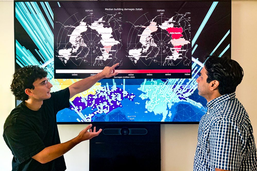
“We can only know the true extent of damages to the built environment if we have a complete representation of the assets that are at risk,” Manos says. “We improved the representation of exposure by mapping buildings in three dimensions.”
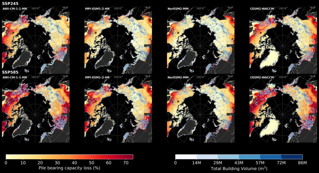
When taking a building’s three-dimensionality into consideration, the researchers estimate that permafrost melt will cost $261 billion by the middle of the 21st century. This is more than double the previous estimate ($110 billion).
This updated estimate is much higher because the materials cost to rebuild multi-story buildings are much higher than single-story buildings.
To calculate this estimate, the researchers used a combination of remote sensing data and artificial intelligence.
Using a large 10 terabyte data set of satellite images, the researchers trained a deep learning model to identify buildings. Next, they trained a different model to classify buildings by use type. This step gave the team a good idea of how high a building is based on if it is residential (like apartments) or non-residential (like a store). They ran these models using supercomputers supported by National Science Foundation and Google funding.
“It’s a lot of resources pulling together to do this kind of work,” Witharana says. “Without the ecosystem or supercomputers and without getting access to these commercial data, it’s not possible.”
Once they had this information, the researchers brought in another dataset called ArcticDEM to estimate the total floorspace of the buildings.
“With this data set, we were able to know what the elevation is at the top of the building,” Manos says. “So, basically, by subtracting the elevation at the base of the building, and the elevation at the top of the building, we can get the building height.”
Finally, they added in information from building codes in the U.S., Canada, and Russia to estimate the average height of each floor in a residential building to then calculate total floor space. The researchers were not able to calculate this for non-residential buildings because there is too much variation between spaces.
The next step was to couple these calculations with projected damages due to permafrost degradation. For this they used a model of permafrost degradation developed by one of the co-authors on the paper, Dmitry Streletskiy at George Washington University.
This paper did not include information on demographic trends which would tell researchers which buildings are likely to remain in use. This is a direction for future research.
Estimating the cost of damages related to permafrost degradation is critical for local Arctic governments that need to develop adaptation plans for their communities, as well as for developing national priorities.
“There are a lot of communities that don’t have the technical or administrative capacity to make these plans,” Manos says. “This requires a lot of data and a lot of computational power to come up with these estimates of damages. This kind of study can help communities and local governments get an idea of what future weather-related events might do to their valuable assets in their communities.”
The researchers have made these findings available to Arctic communities through the Permafrost Discovery Gateway, an international multi-institution effort.
While this study focused on residential buildings, the method the researchers developed could be applied to industrial contexts as well.
“The Arctic has a lot of geopolitical interest and economic importance,” Witharana says. “A lot of industries are operating there, even though the population is low. These kinds of data sets and the methods we derived could help translate this knowledge into industrial and other use types.”
This work relates to CAHNR’s Strategic Vision area focused on Advancing Adaptation and Resilience in a Changing Climate.
Follow UConn CAHNR on social media