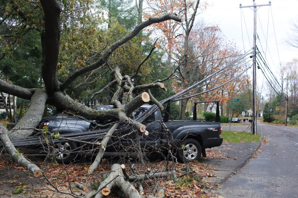
Hurricane Sandy brought devastation to the East Coast on October 29, 2012. With the destabilizing effects of the climate crisis, coupled with sea level rise, these record-breaking disasters are quickly becoming normal occurrences. Communities need to build resilience quickly, and UConn researchers are working on a metric to help coastal areas prioritize which measures to focus on. Their research is published in the International Journal of Disaster Risk Reduction.
Co-author and Associate Professor in the Department of Civil and Environmental Engineering Wei Zhang says Sandy actually brought him to UConn. Following the storm, there was an effort to recruit researchers to focus on resilience and engineering for natural hazards, and with a background in bridge and offshore platform engineering, Zhang, who now leads the Damage Modeling and Disaster Mitigation Lab and is affiliated with the Connecticut Institute for Resilience & Climate Adaptation (CIRCA), came to UConn not realizing that storms as strong as Sandy were a risk for the Northeast.
“My research covers a large spectrum, focusing on the uncertainties of how natural hazards interact with different kinds of infrastructures like bridges, buildings, low residential buildings, and electrical infrastructure,” Zhang says. “In this paper, we focused on what we call livability. We have natural hazards that interact with different components of civil infrastructures in our community and we want to know how the residents will be impacted, whether they’re going to be okay, or they’re going to suffer, and how much they’re going to suffer.”
Zhang explains that it is important for people to know if they are likely to be without power or water, or whether they’ll be able to use roads to get supplies or go to the hospital. This information is vital for planning and for shoring up community infrastructure and individual households.
To study these details, Zhang and his team created a “livability index” that incorporates factors influencing the lives of members of the community. The creation of the index relied on researchers from many different research areas because communities are dynamic and understanding the dynamics required a range of expertise, Zhang says.
“We worked with experts from many disciplines. For instance, geography researchers who work with GIS (Geographic Information System) data, and statisticians and mathematicians on data analysis and quantification. We’re also working with computer science and electrical engineering researchers to understand how the electrical system operates and how we can use machine learning and deep learning to quickly understand infrastructure performance to integrate those together. Of course, environmental modeling for big-scale atmospheric modeling and social sciences to understand how people perceive hazards. There is a lot of collaborative work from different disciplines.”
Preparing for a future of intense storms
The researchers try to account for what will happen if another Superstorm Sandy impacts a community, except the model is calibrated to the more extreme climatic conditions projected for 2100, under two different emissions projections or representative concentration pathways (RCPs). They ran scenarios for a case study, looking at the impacts of hazards and benefits of potential adaptative measures.
“We looked at scenarios and different hazards and asked questions like would you rather be without electricity, without water, without heat, or without transportation?” says Zhang. “It may be different for different households because people have different preferences. The idea is to understand not only how infrastructure is affected but also by how the individual households are going to perceive these hazards.”
Using this information coupled with a future of more intense weather, Zhang says towns can decide which projects to prioritize. For instance, if a road should be repaved, if a pump station should be installed in a flood-prone area, or if an evacuation plan needs to be developed.
“With limited resources, how do we prioritize the action items the community undertakes? We all pay taxes, and we want to help the whole community make decisions that will do the most to prevent as much damage as possible for the community. We’re trying to understand these dynamics.”
In the case of evacuation, the index also accounts for what condition houses will be in post-disaster, including the extent of the damage, what repairs can be expected, and other factors to consider for a quick recovery.
“We may have more snowstorms or more hurricanes, some may be more extreme, but some years they might not happen at all because there is more uncertainty. What do you want to spend to calm your nerves about the uncertainties in front of you?” asks Zhang.
Each community has unique needs, resources, and experiences
Another layer of the livability index is optimization, says Zhang. The researchers try to account for human perception and psychology, as well as social effects so they can better understand how people will perceive the risks.
“Let’s say a group of people are okay to be without power for a few days, but they would not want to be without water,” says Zhang. “If we have that information, then we know that’s what we should focus on. If we only have $100 million to make this community strong, then we can expect the next time we’re going to have certain minor power outages, of course we can’t fix everything, but this information can help to prioritize in a way that makes sense.”
Zhang says he always tries to work directly with communities because each is unique with its own history, challenges, and budget considerations. Since a single solution won’t work for each community, a challenge is to design the livability index in such a way that it can be applied to any community,
“It comes down to what is called ‘good enough,’ and that ‘enough’ concept is very challenging. The problem is how to support the work that needs to be done. If we can establish that with this index, then we hope that every town will be able to easily access and transfer the information to fit their needs,” says Zhang. “We’re trying to solve the problem and help people live better.”
The livability index helps identify a starting point, and Zhang says the next step will be working with more coastal municipalities to begin applying the index and answering this question. It is a big task, and the process is not easy especially, as Zhang points out, because attention to the climate crisis and how people perceive the hazards associated with it may change how things are handled.
“No matter what experts tell people, these disasters might happen or not, but once they do happen or people realize they can happen, it may be easier to prepare. We cannot blame them; this is their life experience, and we shouldn’t challenge that. But certain extremes are happening and it’s beyond what you can see in the past and it could change how people perceive these measures,” says Zhang. “They need to believe the science; they need to trust experts to see what we have done. We need to show the facts and the livability index helps with this.”
If municipal officials are interested in learning more about this research or would like to work with Zhang’s research group, you can contact him at wzhang@uconn.edu.


